![](/images/other/stat-length.png)
![Trail On foot Westport-Belmullet Municipal District - Slí Tóin a' tSeanbhaile / Valley Loop Walk - Photo](https://media.geolcdn.com/t/1900/400/677f1f71-59af-4264-8e32-5db8b94c8a4d.jpeg&format=pjpeg&maxdim=2)
Slí Tóin a' tSeanbhaile / Valley Loop Walk
SityTrail - itinéraires balisés pédestres
Tous les sentiers balisés d’Europe GUIDE+
![Length](/images/other/stat-length.png)
Length
7.3 km
![Max alt](https://static1.geolcdn.com/siteimages/upload/files/1508320355ic_sort_altitude_max_24dp.png)
Max alt
16 m
![Uphill gradient](https://static1.geolcdn.com/siteimages/upload/files/1508320355ic_sort_den_pos_24dp.png)
Uphill gradient
42 m
![Km-Effort](/images/other/stat-length.png)
Km-Effort
7.8 km
![Min alt](https://static1.geolcdn.com/siteimages/upload/files/1508320355ic_sort_altitude_min_24dp.png)
Min alt
1 m
![Downhill gradient](https://static1.geolcdn.com/siteimages/upload/files/1508320355ic_sort_den_neg_24dp.png)
Downhill gradient
37 m
![Boucle](https://static1.geolcdn.com/siteimages/upload/files/16400158638029165_repeat_loop_refresh_sync_direction_icon.png)
Boucle
No
Signpost
Creation date :
2025-02-06 13:12:01.683
Updated on :
2025-02-06 13:12:01.683
![On foot](https://static1.geolcdn.com/sitytour/trail-icons/100.png)
1h46
Difficulty : Easy
![Scan this QR Code to open this trail in the SityTrail application](https://capi.geolives.com/qq0zvz2zws4bq2lad0pu/sitytour/trails/4342961/qr.png?size=200)
FREE GPS app for hiking
About
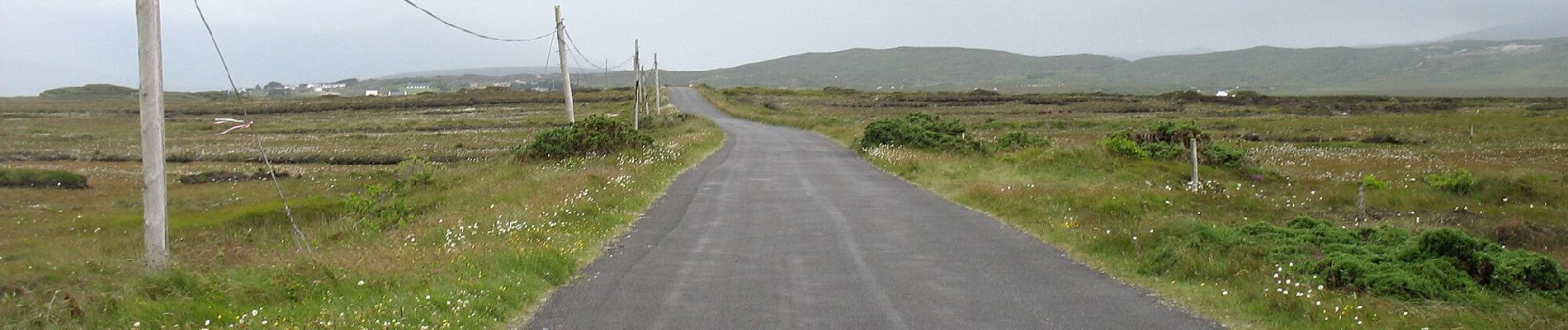
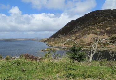
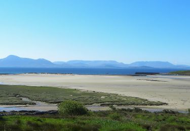
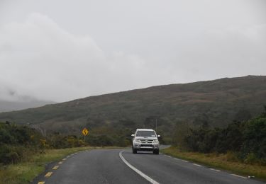
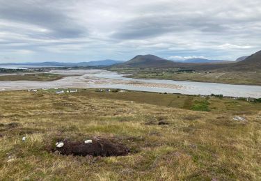
Trail On foot of 7.3 km to be discovered at Unknown, County Mayo, Westport-Belmullet Municipal District. This trail is proposed by SityTrail - itinéraires balisés pédestres.
Description
Website: https://achilltourism.com/valley-loop-walk-sli-toin-a-tseanbhaile/
Positioning
Country:
Ireland
Region :
Unknown
Department/Province :
County Mayo
Municipality :
Westport-Belmullet Municipal District
Location:
Slievemore ED
Start:(Dec)
Start:(UTM)
434780 ; 5985347 (29U) N.
Comments
Trails nearby
![Trail On foot Westport-Belmullet Municipal District - Causeway Loop Walk - Photo](https://media.geolcdn.com/t/375/260/1c76fb76-10fa-4a2e-9183-8a80e5bcbc5c.jpeg&format=jpg&maxdim=2)
![On foot On foot](https://static1.geolcdn.com/sitytour/trail-icons/100.png)
Causeway Loop Walk
On foot
Easy
Westport-Belmullet Municipal District,
Unknown,
County Mayo,
Ireland
![](/images/other/stat-length.png)
4.8 km | 6 km-effort
1h 22min
![](https://static1.geolcdn.com/siteimages/upload/files/16400158638029165_repeat_loop_refresh_sync_direction_icon.png)
No
![Trail On foot Westport-Belmullet Municipal District - Lookout Hill Loop Walk - Photo](https://media.geolcdn.com/t/375/260/bb48f8ac-ba9d-4302-b827-301974dc309f.jpeg&format=jpg&maxdim=2)
![On foot On foot](https://static1.geolcdn.com/sitytour/trail-icons/100.png)
Lookout Hill Loop Walk
On foot
Easy
Westport-Belmullet Municipal District,
Unknown,
County Mayo,
Ireland
![](/images/other/stat-length.png)
6.2 km | 8.3 km-effort
1h 53min
![](https://static1.geolcdn.com/siteimages/upload/files/16400158638029165_repeat_loop_refresh_sync_direction_icon.png)
No
![Trail On foot Westport-Belmullet Municipal District - The Saula Loop - Photo](https://media.geolcdn.com/t/375/260/81e833e1-838c-45c6-a4a1-fcfb7cd4e36b.jpeg&format=jpg&maxdim=2)
![On foot On foot](https://static1.geolcdn.com/sitytour/trail-icons/100.png)
The Saula Loop
On foot
Easy
Westport-Belmullet Municipal District,
Unknown,
County Mayo,
Ireland
![](/images/other/stat-length.png)
8.8 km | 10.8 km-effort
2h 27min
![](https://static1.geolcdn.com/siteimages/upload/files/16400158638029165_repeat_loop_refresh_sync_direction_icon.png)
No
![Trail Walking Westport-Belmullet Municipal District - Granuaile loop - Photo](https://media.geolcdn.com/t/375/260/913f46e2-b5f9-408a-95cb-57e60b2d2dd9.jpg&format=jpg&maxdim=2)
![Walking Walking](https://static1.geolcdn.com/sitytour/trail-icons/101.png)
Granuaile loop
Walking
Medium
Westport-Belmullet Municipal District,
Unknown,
County Mayo,
Ireland
![](/images/other/stat-length.png)
6.9 km | 10.1 km-effort
2h 9min
![](https://static1.geolcdn.com/siteimages/upload/files/16400158638029165_repeat_loop_refresh_sync_direction_icon.png)
Yes
![Walking Walking](https://static1.geolcdn.com/sitytour/trail-icons/101.png)
Mon parcours
Walking
Medium
Westport-Belmullet Municipal District,
Unknown,
County Mayo,
Ireland
![](/images/other/stat-length.png)
7.2 km | 13.5 km-effort
2h 38min
![](https://static1.geolcdn.com/siteimages/upload/files/16400158638029165_repeat_loop_refresh_sync_direction_icon.png)
Yes
![Trail Walking Westport-Belmullet Municipal District - Falaise de Keem - Photo](https://media.geolcdn.com/t/375/260/ext.jpg?maxdim=2&url=https%3A%2F%2Fstatic1.geolcdn.com%2Fsiteimages%2Fupload%2Ffiles%2F1553511878bg_sport_marche.png)
![Walking Walking](https://static1.geolcdn.com/sitytour/trail-icons/101.png)
Falaise de Keem
Walking
Easy
Westport-Belmullet Municipal District,
Unknown,
County Mayo,
Ireland
![](/images/other/stat-length.png)
5.9 km | 11.6 km-effort
3h 0min
![](https://static1.geolcdn.com/siteimages/upload/files/16400158638029165_repeat_loop_refresh_sync_direction_icon.png)
Yes
![Trail Mountain bike Westport-Belmullet Municipal District - Achill Island Loop 2 - Photo](https://media.geolcdn.com/t/375/260/ext.jpg?maxdim=2&url=https%3A%2F%2Fstatic1.geolcdn.com%2Fsiteimages%2Fupload%2Ffiles%2F1524743154velo.jpg)
![Mountain bike Mountain bike](https://static1.geolcdn.com/sitytour/trail-icons/202.png)
Achill Island Loop 2
Mountain bike
Difficult
Westport-Belmullet Municipal District,
Unknown,
County Mayo,
Ireland
![](/images/other/stat-length.png)
27 km | 31 km-effort
2h 9min
![](https://static1.geolcdn.com/siteimages/upload/files/16400158638029165_repeat_loop_refresh_sync_direction_icon.png)
Yes
![Trail Car Westport-Belmullet Municipal District - Achill Island - Easkey WAW part 9 - Photo](https://media.geolcdn.com/t/375/260/ext.jpg?maxdim=2&url=https%3A%2F%2Fstatic1.geolcdn.com%2Fsiteimages%2Fupload%2Ffiles%2F15247431544x4.jpg)
![Car Car](https://static1.geolcdn.com/sitytour/trail-icons/401.png)
Achill Island - Easkey WAW part 9
Car
Very easy
Westport-Belmullet Municipal District,
Unknown,
County Mayo,
Ireland
![](/images/other/stat-length.png)
363 km | 404 km-effort
Unknown
![](https://static1.geolcdn.com/siteimages/upload/files/16400158638029165_repeat_loop_refresh_sync_direction_icon.png)
No
![Trail Walking Westport-Belmullet Municipal District - Achill Croaghaun - Photo](https://media.geolcdn.com/t/375/260/ext.jpg?maxdim=2&url=https%3A%2F%2Fstatic1.geolcdn.com%2Fsiteimages%2Fupload%2Ffiles%2F1553511878bg_sport_marche.png)
![Walking Walking](https://static1.geolcdn.com/sitytour/trail-icons/101.png)
Achill Croaghaun
Walking
Very easy
Westport-Belmullet Municipal District,
Unknown,
County Mayo,
Ireland
![](/images/other/stat-length.png)
12.2 km | 26 km-effort
5h 23min
![](https://static1.geolcdn.com/siteimages/upload/files/16400158638029165_repeat_loop_refresh_sync_direction_icon.png)
Yes